NOAA’s weather satellites: how they watch storms, and what replaces them
Two GOES satellites stare at the Americas from 22,236 miles up while polar orbiters circle the globe. NASA builds them, NOAA flies them, and Congress is deciding how much of the next generation to pay for.
CSU/CIRA & NOAA · GOES-16, October 6, 2024
Drawn from 23 sources: NOAA NESDIS (11), NASA (3), NOAA (3), Congressional Research Service (2) and 4 others. About 12 minutes. Checked October 1, 2026.
Each spring brings the increasing probability of severe weather to the United States, and each summer and fall bring hurricanes. From their orbits, NOAA satellites detect and track that weather, giving forecasters the data they need to predict and monitor life-threatening conditions. The Geostationary Operational Environmental Satellites, GOES, provide continuous coverage of severe weather threats, while the polar-orbiting satellites of the Joint Polar Satellite System, JPSS, deliver higher-resolution global observations for longer-range forecasts.1
NOAA’s satellite service, the National Environmental Satellite, Data, and Information Service (NESDIS), procures, launches and manages the nation’s civil operational environmental satellites. It operates 15 active satellites, including five geostationary, five polar-orbiting and two in deep space, and 95 percent of the data used in weather forecasting models comes from satellites.21 The work is split between two agencies: NASA builds and launches the satellites for NOAA, which operates them and distributes their data to users worldwide.2 As of October 1, 2026, GOES-19 watches the Atlantic side of the hemisphere as GOES East and GOES-18 the Pacific side as GOES West, while NOAA-20, NOAA-21 and the NOAA/NASA Suomi NPP satellite circle the planet from pole to pole.8,10
Two satellites that keep pace with Earth’s rotation
GOES satellites orbit 22,236 miles above Earth’s equator at speeds equal to the Earth’s rotation. That lets them hold their positions over the same regions and provide continuous coverage of them. Together, GOES East and GOES West watch over more than half the globe, from the west coast of Africa to New Zealand and from near the Arctic Circle to the Antarctic Circle.2 Because they stay above a fixed spot on the surface, they keep a constant watch for the atmospheric “triggers” of severe weather: severe thunderstorms, tornadoes, large hail and flash floods. When those conditions develop, the satellites monitor the storms and track their movements.1
35,786 km up, over the equator
Geostationary orbit
Here a satellite circles once a day and seems to hang over one place. NOAA’s GOES satellites watch the Americas from two such points.
Drag to turn. Distances and sizes are to scale.
It all began in October 1975 with the launch of GOES-1, which gave forecasters their first near real-time look at atmospheric conditions from a fixed location. Before GOES, forecasters had no accurate information about where and when hurricanes would come ashore; the new satellites quickly began providing it. GOES-7, launched in 1987, added the ability to detect distress signals from emergency beacons. In 1994 GOES-8 brought three-axis stabilization and separate optics for imaging and sounding, so the satellite could interrupt its routine scans of the hemisphere to concentrate on a small area of fast-changing weather.3 NOAA has fielded a new generation of geostationary satellites about every two decades since 1975.16
The current generation, the GOES-R Series, began flying in 2016. Its satellites carry a letter during development and are renamed with a number once they reach geostationary orbit. GOES-R (now GOES-16) launched in 2016 and GOES-S (GOES-17) in 2018; GOES-T (GOES-18) launched in 2022 and is GOES West, and GOES-U (GOES-19) launched in 2024 and is GOES East. GOES-16 is the primary backup, and GOES-17 is in on-orbit storage.2,3
Hurricane Milton, imaged every five minutes for a day
GOES-16 GeoColor imagery of Milton crossing the Gulf of Mexico, October 8–9, 2024.
Each GOES-R satellite carries an Advanced Baseline Imager (ABI), which detects visible and infrared light in 16 spectral bands. It can capture a full-disk image every 10 minutes, an image of the U.S. mainland every five minutes, and images of one or two smaller areas every 30 to 60 seconds. Compared with the previous GOES-N series, which launched its last satellite in 2010, the ABI provides three times more spectral data with four times the resolution, and delivers it five times faster.4
The ABI is the primary tool forecasters use to identify a developing tropical cyclone. They use its imagery to track the storm and estimate its intensity, and to follow dry air and wind shear, which can limit a storm’s ability to strengthen. The same data locate the storm’s center of circulation, which guides reconnaissance aircraft such as NOAA’s Hurricane Hunters.4 In 2017, when Hurricane Maria knocked out the radar in Puerto Rico just before landfall, forecasters tracked the storm with 30-second data from GOES-16.3
On October 8, 2024, GOES East, then GOES-16, watched Hurricane Milton approach the Gulf Coast of Florida. At its most powerful, Milton’s maximum sustained winds reached 180 mph, an extremely dangerous Category 5 hurricane. By the time its eye made landfall near Siesta Key in Sarasota County, it was a Category 3 storm with winds up to 120 mph.5
Lightning mapped from geostationary orbit
The film shows Milton’s eye at sunrise on October 7, 2024, as GOES-16 saw it, with the lightning its mapper detected in the eyewall drawn in blue.13 The GOES-R satellites carry the first operational lightning mapper flown in geostationary orbit. The Geostationary Lightning Mapper (GLM) is a single-channel, near-infrared optical detector that maps in-cloud, cloud-to-cloud and cloud-to-ground flashes. From its vantage point it can monitor large areas over time, even over oceans and regions with little radar coverage.2,6
Rapid increases in lightning can indicate that a thunderstorm is intensifying. Radar updates roughly every five minutes; the lightning mapper updates every 20 to 60 seconds. Storms that go on to produce damaging winds, hail and tornadoes often show a jump in lightning activity, and with the GLM that jump can be seen minutes before radar detects signs of severe weather. In hurricanes, lightning patterns show changes in the storm’s structure and intensity.6
Satellites cannot see tornadoes from space. By tracking cloud motion and lightning, they help meteorologists identify the storms with the potential to produce them.1 The mapper takes 500 images of Earth every second, fast enough that it also records bright meteors.6
Who builds a GOES satellite, and what the series costs
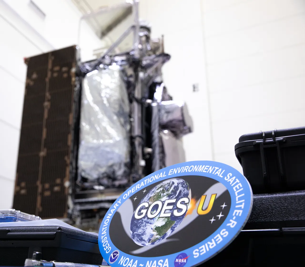
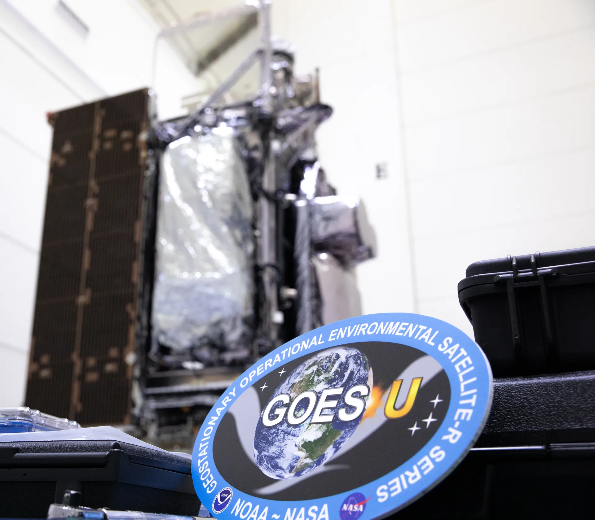
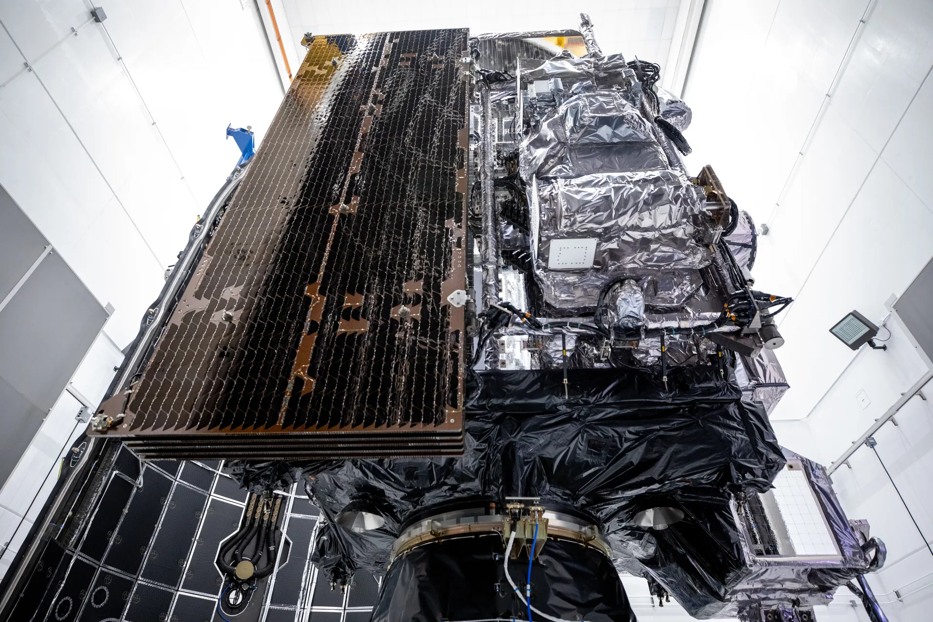
NASA’s Goddard Space Flight Center in Greenbelt, Maryland, oversaw the acquisition of the GOES-R series spacecraft and instruments and built the magnetometer for GOES-U and its predecessor, GOES-T. NASA’s Launch Services Program at Kennedy Space Center managed the launches. Lockheed Martin designs, builds and tests the satellites; L3Harris Technologies provides the main instrument, the Advanced Baseline Imager, and the ground system, including the antennas that receive the data. NOAA oversees the program through an integrated NOAA-NASA office that manages the ground system, operates the satellites and distributes the data.7
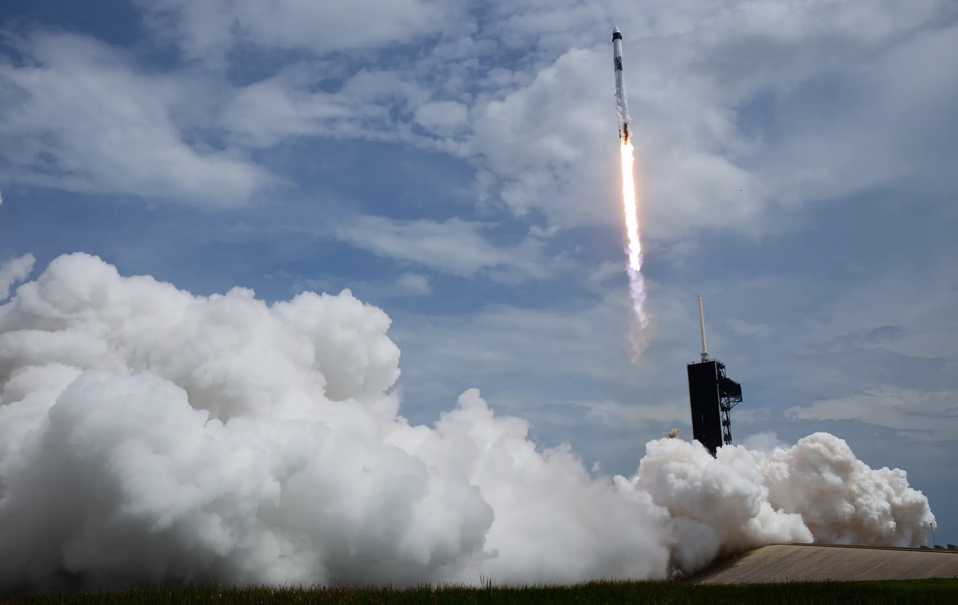
GOES-U, the fourth and final satellite in the series, lifted off on a SpaceX Falcon Heavy from Launch Complex 39A at Kennedy on June 25, 2024. It added a space weather instrument, the Compact Coronagraph-1, which blocks the Sun’s bright light so scientists can observe the fainter solar atmosphere.7 It became GOES-19 when it reached geostationary orbit on July 7, 2024, and after its instruments were tested it began operations as GOES East on April 7, 2025, positioned at 75.2 degrees west longitude. GOES-16 moved into the backup role.8,9
NOAA’s 2027 budget puts the life-cycle cost of the GOES-R Series at $11.7 billion, including ground system sustainment and operations through the end of the program in 2036.9

Polar orbiters that supply most of the forecast models’ data
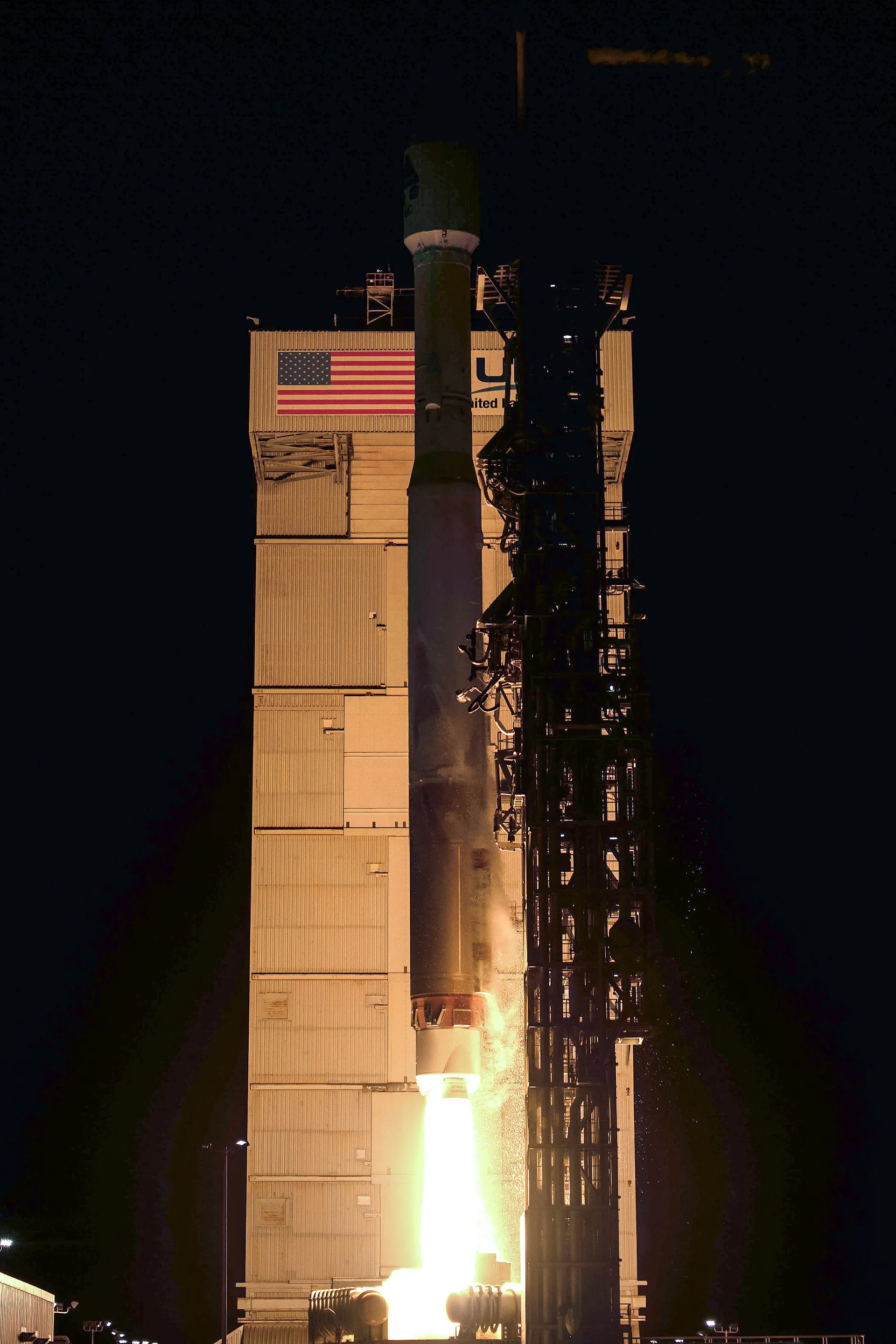
NOAA’s JPSS satellites circle the Earth from pole to pole 14 times a day at an altitude of about 512 miles, covering the whole planet twice a day. Their data are the foundation of the numerical weather models that produce three- to seven-day forecasts: around 85 percent of the data that goes into forecast models comes from polar-orbiting satellites, whose instruments measure temperature and water vapor throughout the atmosphere.1
Each satellite carries the Cross-track Infrared Sounder and the Advanced Technology Microwave Sounder, which measure conditions at the various levels of the atmosphere for the models, and the Visible Infrared Imaging Radiometer Suite (VIIRS), which gives a closer, more detailed look than the geostationary satellites.1 NASA is the acquisition agent here too: Goddard manages the JPSS Flight Projects Office, which oversees the purchase of the instruments and spacecraft, and a combined NOAA and NASA team manages the program.11
The next satellite, JPSS-4, will be renamed NOAA-22 in orbit. In July 2024 NASA chose SpaceX to launch it on a Falcon 9 from Vandenberg under a firm fixed-price contract worth about $112.7 million. It will carry the four instruments flown on NOAA-21 plus Libera, a NASA instrument that measures Earth’s energy budget.10,11
NOAA’s 2027 budget gives JPSS-4 a launch commitment date in the first quarter of fiscal 2028, which is late calendar 2027, and JPSS-3 one in the first quarter of fiscal 2033. The two satellites swapped places in 2023 so that Libera could fly sooner; JPSS-3 will be stored and checked periodically until its turn. Suomi NPP is to be deorbited in fiscal 2027, the first satellite NOAA is required to deorbit under U.S. orbital debris rules. NOAA puts the life-cycle cost of the JPSS satellites at $11.3 billion, and of the follow-on pair, JPSS-3 and JPSS-4, at another $6.8 billion.9
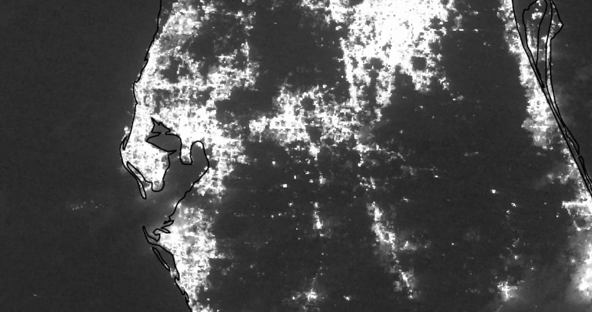
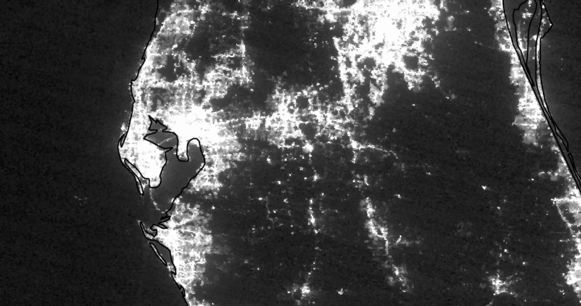
VIIRS also has a Day/Night Band, sensitive to very small amounts of visible light at night: moonlight reflecting off clouds or snow, fires and city lights. After severe weather strikes, it gives a broad sense of where power is out and infrastructure may be damaged.1 In July 2024 NOAA-21 recorded the power loss across East Texas after Hurricane Beryl’s landfall, most noticeably in the Houston area, by comparing nighttime lights on June 9 and July 9. Beryl was the earliest Category 5 hurricane observed in the Atlantic basin on record. The band scans the entire Earth twice a day at a resolution of 750 meters.12 Three months later NOAA-20 made the same comparison for Milton.13
Watching the Sun and listening for distress beacons
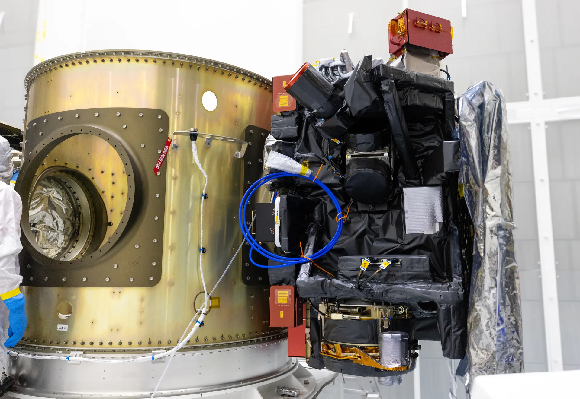
On June 10, 2026, NOAA’s SOLAR-1 entered operational service as the first U.S. satellite designed exclusively for continuous, operational space weather observations. Launched as SWFO-L1 on a Falcon 9 from Kennedy on September 24, 2025, it traveled nearly one million miles over four months to the Sun-Earth Lagrange point 1, where it monitors the solar wind and observes coronal mass ejections. Its coronagraph delivers imagery to NOAA’s Space Weather Prediction Center within 30 minutes, compared with up to eight hours for the coronagraph on the ESA-NASA Solar and Heliospheric Observatory, and its solar wind data arrive within five minutes.14
The same polar-orbiting and geostationary satellites are part of COSPAS-SARSAT, the international system that detects and locates distress signals from 406 MHz beacons on aircraft and boats and from personal locator beacons. In 2025 NOAA’s satellites helped rescue 300 people in the United States and its surrounding waters: 183 at sea, 47 in aviation incidents and 70 on land.15
GeoXO: a $19.6 billion plan cut to $11.9 billion
NOAA expects the GOES-R Series to end in the early 2030s. In 2019 it began defining requirements for the successor, Geostationary Extended Observations, or GeoXO. The Department of Commerce approved the program in December 2022 with a budget of $19.6 billion covering operations to 2055, which would have made it NOAA’s largest procurement ever. The plan called for six spacecraft, at most three operating at once over the west, center and east of the hemisphere, carrying five instruments: an improved imager and lightning mapper, a new hyperspectral sounder, an atmospheric composition instrument and an ocean color instrument. NASA, as acquisition agent, awarded contracts for all of them in 2023 and 2024, including the imager to L3Harris, the sounder to Ball Aerospace and the spacecraft to Lockheed Martin, whose contracts were valued in July 2026 at $620.9 million, $386.8 million and $1.8 billion.16
In April 2025 an internal Office of Management and Budget passback directed NOAA to “immediately cancel all major instruments and spacecraft contracts on the GeoXO program” because its projected budget was “unsustainable.” The administration aimed to halve the program’s life-cycle cost, keep annual spending below $500 million and refocus GeoXO on weather. It dropped the central satellite and the atmospheric composition, ocean color and lightning instruments, and NOAA discontinued those contracts. Congress answered in the explanatory statement accompanying the fiscal 2026 appropriations law of January 2026: the revised architecture “must include imaging and sounding as the core instruments for all satellites.”16
How the GeoXO plan changed
December 2022
Program approved16
Six spacecraft, five instruments, $19.6 billion through 2055.
2023–2024
NASA awards the contracts16
Imager to L3Harris, sounder to Ball Aerospace, spacecraft to Lockheed Martin, plus three more instruments.
April 2025
Budget office orders cancellation16
An OMB passback calls the program’s projected budget “unsustainable.”
2025
Four satellites proposed16
The central satellite and the ocean color, atmospheric composition and lightning instruments are cut.
January 2026
Congress sets the core16
Imaging and sounding on every satellite, first launch kept in 2032.
April 27, 2026
New baseline approved16
Four satellites, each with an imager and a sounder; life-cycle cost $11.9 billion.
2032 (planned)
First GeoXO launch9
A GOES-R-era imager and the new GeoXO Sounder.
The baseline the Deputy Secretary of Commerce approved on April 27, 2026, follows that direction: four satellites in two pairs, for the East and West positions, each carrying an imager and the new sounder. The first, designed to launch in 2032, will carry a GOES-R-era Advanced Baseline Imager and the new GeoXO Sounder; the others are planned for 2034, 2039 and 2043. NOAA estimates the program’s life-cycle cost at $11.9 billion and says its contracts are moving from cost-plus to firm-fixed-price.9,16
The details have consequences. Putting today’s imager on the first satellite keeps imaging at its present quality but delays the advanced GeoXO Imager from that position until 2039. The program no longer includes a lightning mapper; in January 2026 NOAA was comparing space-based mappers with commercial ground-based lightning data, which are less able to show how rapidly hurricanes intensify over the ocean. And some stakeholders have questioned whether one spacecraft can carry two instruments that are each the size of a small car.16
The polar follow-on starts with one small satellite
In low Earth orbit, NOAA’s follow-on to JPSS is the Near Earth Orbit Network, NEON, which takes a “Buy, Partner, Build” approach: use commercial capabilities, partner with federal and international agencies, and build only what it must. NASA will manage the development and launch of the satellites, and NOAA will operate them.9,17 The first project, QuickSounder, is meant to show that NOAA can launch a small satellite with a single instrument within three years, instead of the ten years or more that multi-instrument satellites take. It will fly a refurbished Advanced Technology Microwave Sounder like those on the JPSS satellites.17 NASA chose Firefly Aerospace in September 2024 to launch it, with a launch readiness date of February 2026.18 As of October 1, 2026, it had not flown; NOAA now expects it to launch in 2027.17 The next step, NEON Series 1, is to buy a block of four small commercial spacecraft carrying a new microwave sounder.9
NOAA is also buying more data outright. On September 18, 2026, its Commercial Data Program awarded three two-year contracts worth $67 million to Spire Global, PlanetiQ and Ethereal Space for 10,000 radio occultation profiles a day, measurements of how radio signals bend through the atmosphere from which NOAA derives temperature, pressure and moisture for its forecast models.19
The 2026 fight over NOAA’s satellite budget
Congress pays for NOAA’s satellites through the annual Commerce, Justice, Science appropriations bill. For fiscal 2026 the administration requested deep cuts across most of NOAA; in the law signed in January 2026, Congress gave every line office more than was requested.20 The fiscal 2027 request, released in April 2026, asked for $4.54 billion in discretionary appropriations for NOAA, $1.1 billion less than the fiscal 2026 level, and again proposed eliminating NOAA’s research office. The satellite service would fall to $1.576 billion from $1.666 billion. Within it, the request included $500 million for GeoXO, $125 million for NEON (an increase of $5 million), $9.75 million more for commercial data, and a $47.8 million cut from streamlining satellite operations, starting with handing GOES-R data operations to a contractor.9,21
Money for NOAA’s satellite service, in millions of dollars21
Show the numbers
| year | NESDIS appropriations |
|---|---|
| FY2024 enacted | $1,800M |
| FY2026 enacted | $1,666M |
| FY2027 request | $1,576M |
| FY2027 House bill | $1,756M |
The House Appropriations Committee rejected most of the cuts in May 2026. Its bill would give NOAA nearly $6.5 billion in discretionary direct obligations, about 1 percent less than in fiscal 2026, and NESDIS about $1.76 billion. It provides $677 million for geostationary satellites and “reaffirms support for incorporating GeoXO Imager and GeoXO Sounder instruments on both East and West geostationary satellites, while maintaining first launch in 2032.”20,22 No Senate bill had been introduced by late July, and by September the Senate Appropriations Committee had reported none of its fiscal 2027 bills.20,23 Fiscal 2027 began on October 1, 2026, under a continuing resolution that funds the government at fiscal 2026 rates through December 11.23
The year 2032 keeps appearing in those reports for a reason. NOAA says the first GeoXO satellite is being designed to launch then to avoid a gap between the GOES-R Series and its successor. A 2026 report by the Commerce Department’s Inspector General, based on the earlier plan, found that if the first GeoXO launch slipped and a GOES-R satellite failed, imaging coverage could lapse for at least three months; the White House budget office judged in 2025 that the health of the GOES-R satellites minimized that risk.9,16
Sources
The text above is drawn from these 23 sources. Government works are adapted closely; company and press material is summarized. Numbers in the text point here. Last checked October 1, 2026.
Show all 23 sourcesShow fewer
- 1Back to the text
- 2Back to the text
- 3Back to the text
- 4Back to the text
- 5Back to the text
- 6Back to the text
- 7Back to the text
- 8Back to the text
- 9Back to the text
- 10Back to the text
- 11Back to the text
- 12Back to the text
- 13Back to the text
- 14Back to the text
- 15Back to the text
- 16Back to the text
- 17Back to the text
- 18Back to the text
- 19Back to the text
- 20Back to the text
- 21Back to the text
- 22Back to the text
- 23Back to the text
Continue

Related stories
- OrbitsHeight sets a satellite’s speed; tilt and shape set what it sees. Five neighborhoods, from the station about 400 km up to Webb 1.5 million km away, and the work each one makes possible.
- GPSA receiver finds itself by timing signals from four satellites. The Space Force runs the system, finished GPS III in April 2026, and canceled the ground system that was meant to replace the old one.
- NASA’s budgetIn 1966 NASA spent 4.4 cents of every federal dollar; today about a third of a cent. Where its roughly $25 billion a year goes, how it is decided, and why Congress keeps rejecting an $18.8 billion request.