Landsat: 54 years of watching the land, and what comes after Landsat 9
Since 1972 Landsat satellites have recorded Earth’s land, and since 2008 anyone can download the record free. NASA builds them and the USGS runs them; the next one has been redesigned, and its budget is in dispute.
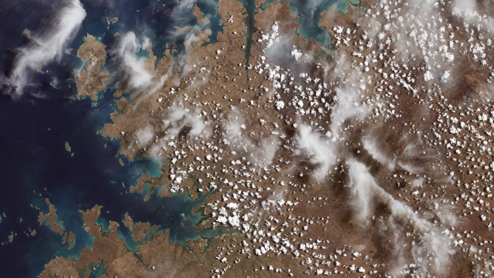
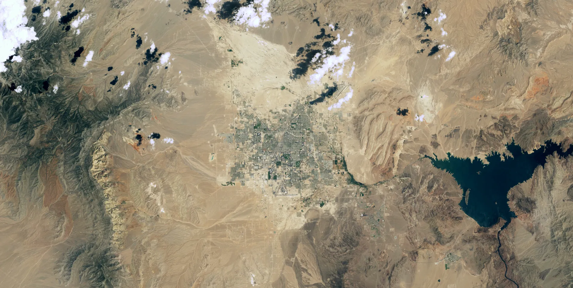
NASA/USGS · Landsat 9 OLI-2, October 31, 2021
Drawn from 25 sources: NASA (8), USGS (4), NASA Scientific Visualization Studio (3), Congressional Research Service (3) and 5 others. About 10 minutes. Checked October 1, 2026.
The Landsat program is a series of Earth-observing satellites jointly managed by NASA and the U.S. Geological Survey. Since 1972, Landsat satellites have continuously acquired images of the Earth’s land surface, building an uninterrupted archive that land managers, planners and policymakers use to make decisions about natural resources and the environment. With each new launch the record becomes more valuable: researchers have used it to study how cities have grown, coastlines have shifted, crop cycles have changed and forests have transformed since the 1970s. Landsat’s free and publicly accessible data contributed an estimated $25.6 billion to the U.S. economy in 2023 alone.1
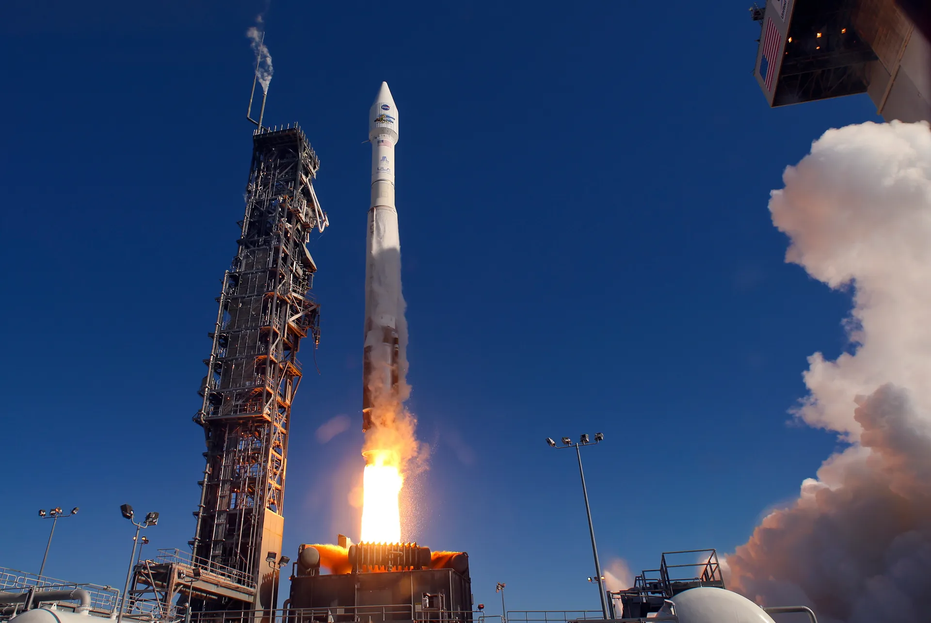
NASA builds and launches the satellites and puts each one through months of calibration and testing in orbit; then the USGS takes over day-to-day operations and data management.2,12 On September 27, 2026, Landsat 9 completed its five-year design life, 54 years after Landsat 1 was launched. Working with Landsat 8, it images any given place about every eight days, and the two satellites add about 1,500 scenes a day to the archive.2 The next satellite, Landsat 10, is being designed for launch readiness by December 2031, and how it should be paid for is in dispute between the administration and Congress.21,22,23
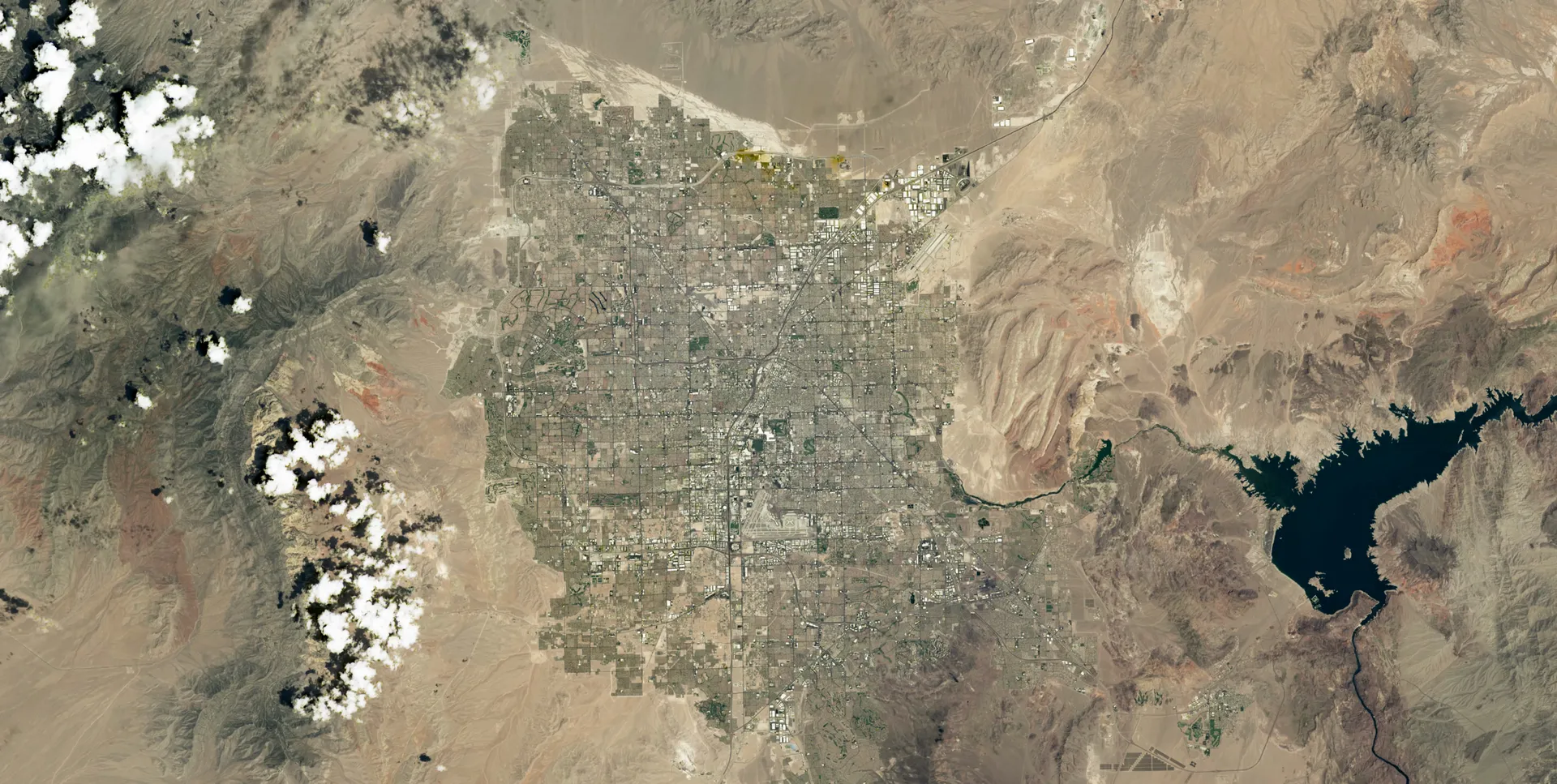
Las Vegas is one of the cities the record follows. Established in 1905, it had its first growth spurt in the 1930s, when gambling was legalized and construction of Hoover Dam began, and its population has since reached nearly two million, making it one of the fastest-growing metropolitan areas in the world.3
Gemini photographs and a weather satellite turned toward the land
In the 1960s, the view of Earth from space was new. Photographs sent back by Gemini astronauts showed never-before-seen views of the planet, and many scientists immediately recognized that such high-altitude imagery could be useful for geological research. William Pecora, then director of the USGS, was so inspired that he proposed a satellite program to monitor Earth from space.4 NASA officially established the Earth Resources Technology Satellite program in 1967.6
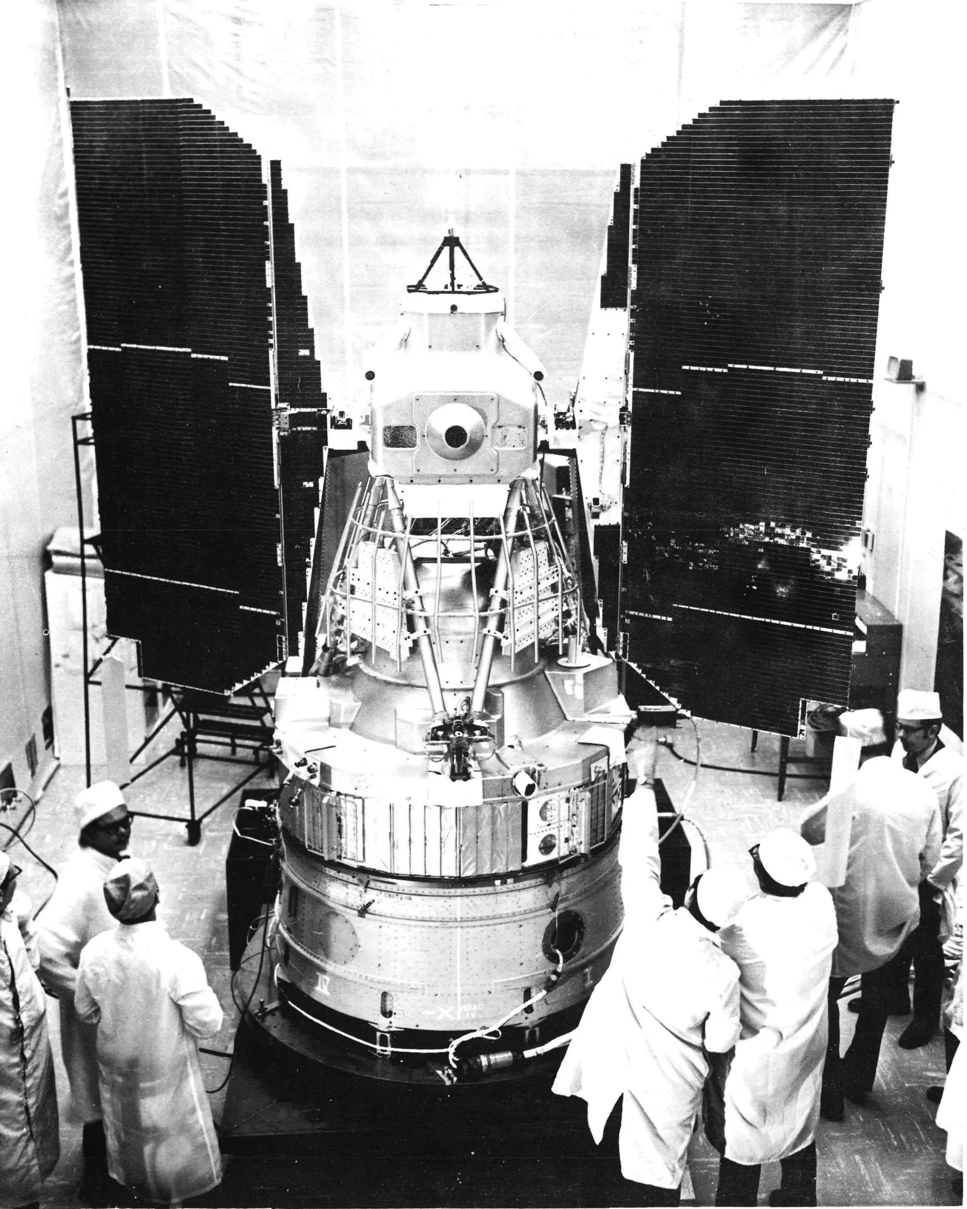
The first satellite, ERTS-1, launched on July 23, 1972, and was later renamed Landsat 1. It was the first satellite mission dedicated to monitoring Earth’s land surfaces. The spacecraft was a modified Nimbus 4 meteorological satellite, which is why it so closely resembles the Nimbus weather satellites, and it carried two instruments: the Return Beam Vidicon, three television cameras built by RCA, and the Multispectral Scanner System, built by Hughes Aircraft Company.5
The cameras were supposed to be the primary sensor. On August 6, 1972, a power surge associated with them caused a loss of attitude control, and the cameras were permanently deactivated 15 days after launch. The Multispectral Scanner, proposed as an experimental, secondary instrument, became the primary one. Designed by Virginia Norwood, now recognized as the mother of Landsat, it used an oscillating mirror to build digital images in four spectral bands at about 80-meter resolution. It was the first space-based instrument to digitally encode, record and transmit Earth data, and it turned remote sensing from an analog, photographic discipline into a quantitative science.5
Landsat 1 orbited the entire planet every 18 days. By the end of 1973 it had captured nearly complete global land coverage, much of it with little cloud, and it kept working until January 6, 1978.5
In 1972, less than half of Earth’s surface had been accurately mapped, and only about 40 percent of the United States had been mapped at the standard USGS scale of 1:250,000. Scientists used Landsat 1 data to show how out of date the existing maps were, to chart large regions of Africa, Asia and South America, to redraw 1,200 miles of Antarctic coastline and to correct nautical charts.5
Agriculture followed almost immediately. In the early 1970s the United States, unaware of a worldwide shortage, sold 15 million tons of wheat to the Soviet Union at a large discount; the sale, later called the “Great Grain Robbery,” created a domestic shortage and wheat prices skyrocketed. The government wanted an accurate, up-to-date way to track crops worldwide and turned to Landsat 1, and NASA’s Johnson Space Center coordinated a project to test automated crop identification with its data.5
Nine satellites, one lost on the way to orbit
When the program began, the plan was to build a series of spacecraft, because without continuous observation there would be a lapse in the data that would interrupt science.7
Landsat 1 through Landsat 10
July 23, 1972
Landsat 1 (ERTS-1)5
The Multispectral Scanner; worked until January 1978.
January 22, 1975
Landsat 27
Built for one year, it lasted seven.
March 5, 1978
Landsat 37
Launched by NASA, operated by NOAA.
July 16, 1982
Landsat 47
Added the Thematic Mapper; operations later contracted to a private company.
March 1, 1984
Landsat 58
Designed for three years, it operated for nearly 29.
October 5, 1993
Landsat 69
The only commercial launch of the program; it never reached orbit.
April 15, 1999
Landsat 710
Science mission ended in 2024; decommissioned June 4, 2025.
February 11, 2013
Landsat 87
Operational Land Imager and Thermal Infrared Sensor.
September 27, 2021
Landsat 911
First mission of the Sustainable Land Imaging Program.
December 2031 (planned)
Landsat 1021
One satellite with a 26-band instrument suite.
Landsat 5 became one of the most productive Earth-observing satellites ever flown. Its Thematic Mapper and Multispectral Scanner collected about 3.8 million scenes over nearly 29 years, and it holds a Guinness World Record for the longest-operating Earth observation satellite mission. It overlapped with Landsat 4 for its first decade and with Landsat 7 for its last 14 years, which let engineers cross-calibrate the sensors and keep the record continuous.8 Landsat 7 spent more than 8,900 days collecting science data, which account for over 3 petabytes in the USGS archive. It was lowered out of the way of other satellites, and the USGS sent its final command on June 4, 2025.10
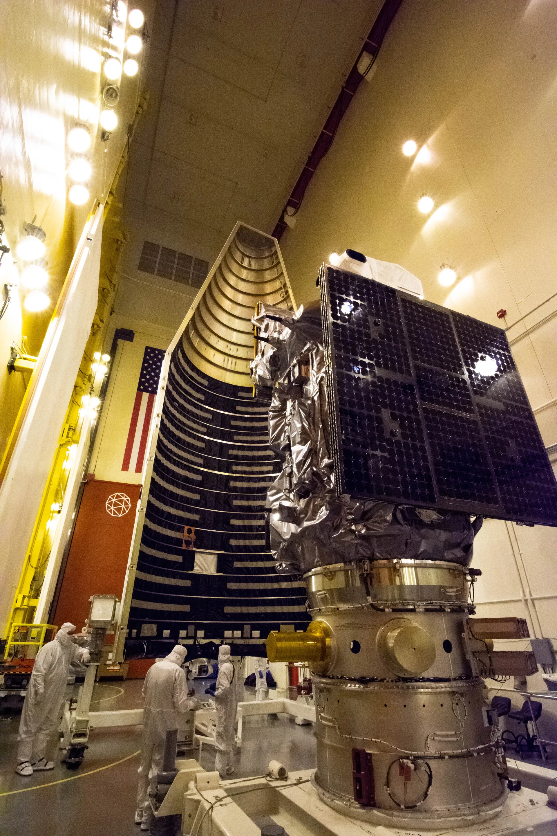
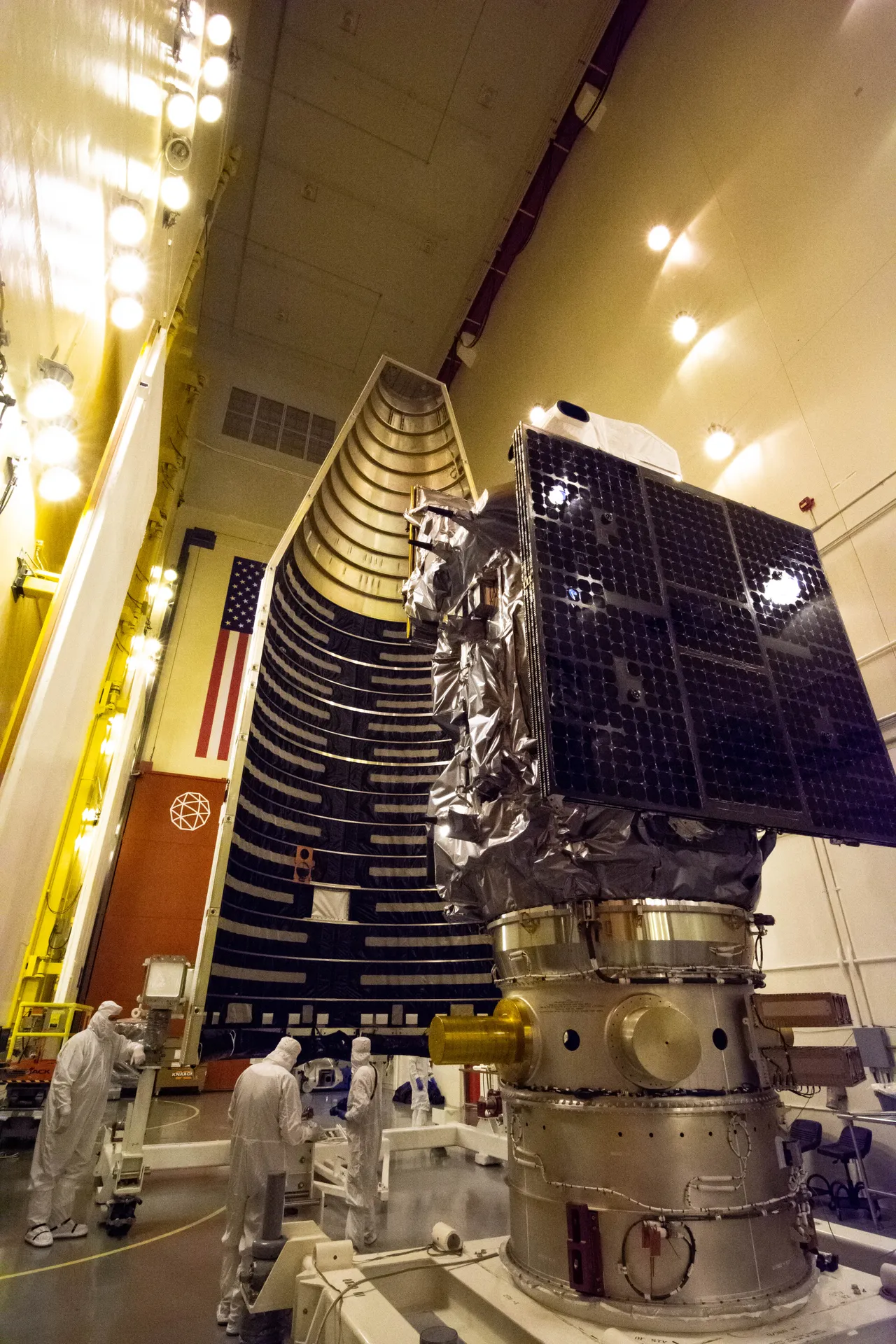
In 2016 NASA and the Interior Department formalized their partnership as the Sustainable Land Imaging Program. In practice, NASA develops the satellites and instruments, launches them and checks their performance; the USGS takes over operations and manages the data at its Earth Resources Observation and Science (EROS) Center in Sioux Falls, South Dakota.12 For Landsat 9, Northrop Grumman designed and built the spacecraft, adapting the LEOStar design used for Landsat 8, integrated the two instruments and tested the satellite. Ball Aerospace built the Operational Land Imager 2, and NASA’s Goddard Space Flight Center built the Thermal Infrared Sensor 2. The imager collects 14-bit data, up from 12 bits on Landsat 8, so it can distinguish more subtle differences in very bright and very dark surfaces.11
NASA spent $857 million on Landsat 8. For Landsat 9 it committed to a life-cycle cost of no more than $885 million, and the USGS spent more than $120 million on the ground system.13 Landsat 9 collects about 740 scenes a day, almost double its requirement, and carries enough fuel to operate for at least ten years.11
From $6,000 a scene to free
William Pecora believed from the start that the data from the future ERTS-1 should be free.6
I believe strongly that the data must be freely available to the resources and scientific communities, on a timely basis; restricted use of the data is not in keeping with the traditions of our Department.
Fees were charged anyway when the satellite began returning images in 1972, largely because of processing time: there were very few image processing programs, and the images were large for the time. Most users were academic scientists and government agencies with mainframe computers and money to buy images; one Multispectral Scanner image cost $200 in 1979. The Land Remote Sensing Commercialization Act of 1984 transferred Landsat operations to the private sector, with the intention that revenue from commercial sales would pay for the program. Prices rose from $650 a scene to $2,800 and up to $6,000, and demand sharply declined.6 A company, EOSAT, operated the program from 1985 to 2001.14 Landsat 6, built by Martin Marietta Astro Space with EOSAT responsible for the spacecraft and ground system under a Commerce Department contract, was lost at launch in 1993.9
In the Land Remote Sensing Policy Act of 1992, Congress found that “the cost of Landsat data has impeded the use of such data for scientific purposes,” and commercialization came to an end. After Landsat 7 launched in 1999, the USGS set the price of a scene at $600.6 In fiscal 2001, the busiest year before the policy changed, the archive delivered 25,000 scenes.16
In January 2008 Barbara Ryan, the USGS associate director for geography, and Michael Freilich, director of NASA’s Earth Science Division, signed the Landsat Data Distribution Policy, which made Landsat images free to the public; the USGS announced it on April 21, 2008. Newly acquired Landsat 7 images became available at no charge that summer, and by February 2009 the entire archive could be downloaded.6,15 Ryan’s argument was that most images had been bought with federal money anyway, so “at the Federal government level, we were just taking money from one pocket and putting it into another.”14
- 53
- scenes a day left the archive when they cost money15
- 5,775
- scenes a day once the price was removed15
- 160M
- Level-1 scenes downloaded from 2008 to 202316
- 31,000 TB
- of Landsat data accessed in fiscal 2025, eight times the 2020 volume17
The one millionth free scene was downloaded ten months after downloads began on October 1, 2008, and the 100 millionth on March 9, 2020.14 Since 2020 a copy of the archive has also been held in a commercial cloud, where users can analyze the data without downloading it; the volume accessed grew from less than 4,000 terabytes in fiscal 2020 to more than 31,000 terabytes in fiscal 2025.17 The way research is done changed with it. Studies could now examine every Landsat scene of an area over a year, five years or decades, and changes in forests and surface water have been mapped for the entire globe.16
A record that cannot be collected later
Landsat 1 was the first Earth observation satellite designed to obtain calibration data in orbit.5 That calibration is what makes the archive worth comparing across decades: scientists can be confident that changes between Landsat images reflect changes on the ground, not in the instruments.1
You can launch a new satellite, but you can’t put something up in the past. Landsat will always be that historic record that new satellites can tie themselves to.
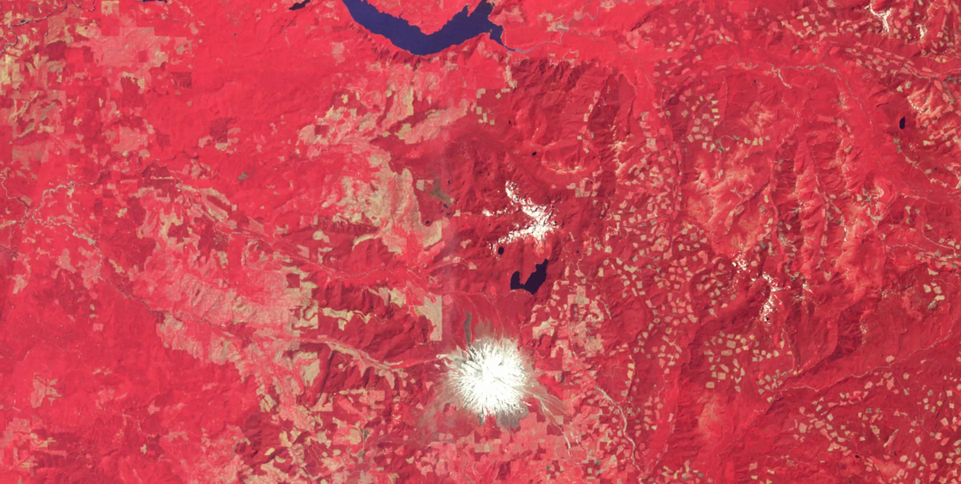
Landsat, 1975 · NASA Goddard/Ross K. Walter (SSAI)
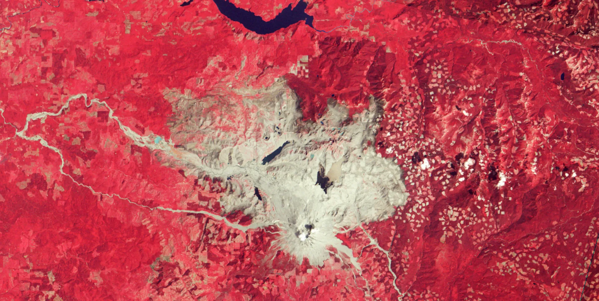
Landsat, 1981 · NASA Goddard/Ross K. Walter (SSAI)
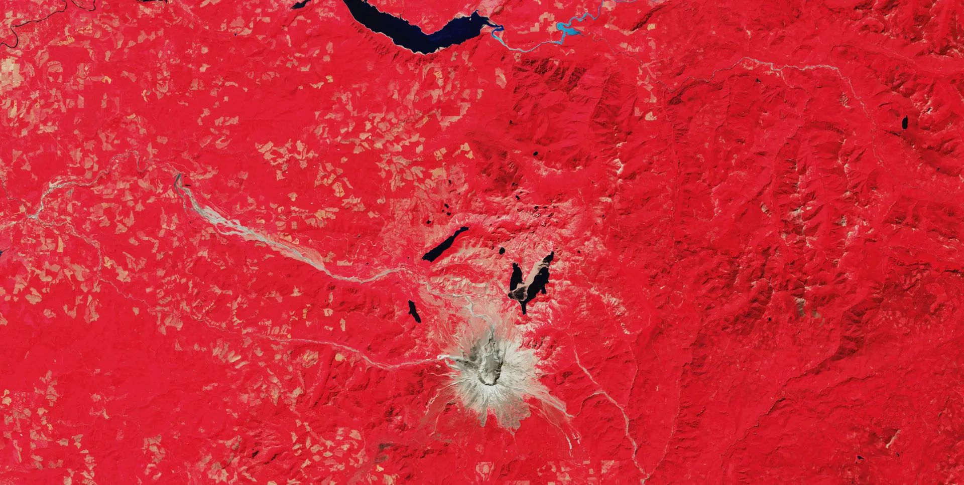
Landsat, 2025 · NASA Goddard/Ross K. Walter (SSAI)
1975: forest around a quiet volcano
Landsat recorded Mount St. Helens in Washington State in 1975, five years before it erupted. In this near-infrared view, plant life appears bright red.18
1981: 230 square miles of forest destroyed
In 1980, Mount St. Helens erupted and destroyed 230 square miles of forest. In the Landsat image taken the next year, volcanic ash and rock appear gray across the blast zone north of the mountain.18
2025: four decades of recovery
The eruption gave scientists an unprecedented opportunity to watch the steps through which life reclaims devastated ground. The first noticeable recovery, in the late 1980s, came in the northwest of the blast zone, farthest from the volcano; it was another decade before the terrain east of Spirit Lake was considerably greener. By 2017 the only area beyond the slopes of the mountain that remained conspicuously bare at this scale was the Pumice Plain.25
Landsat Next becomes Landsat 10
In 2022 NASA and the USGS presented the first details of Landsat Next, envisioned as a constellation of three satellites sent into orbit on the same launch vehicle in or after 2030. It was meant to improve temporal, spatial and spectral resolution by two to three times: a six-day revisit instead of eight days, 26 spectral bands instead of 11, and about 15 times more data than Landsat 9. Congress provided funds to start it in fiscal 2024, and on June 13, 2024, NASA selected Raytheon to design and build the Landsat Next Instrument Suite, LandIS.12
One criticism of Landsat Next was the cost of the mission and its ground system to the NASA and USGS budgets. The National Academies’ decadal strategy committee stated that “Landsat Next goes substantially beyond providing simple continuity of the existing Landsat observations.” The fiscal 2026 budget request, released May 2, 2025, proposed restructuring the mission while studying more affordable ways to keep the record going, with $70 million for Sustainable Land Imaging and nothing for Landsat Next.12
By May 2026 NASA and the USGS had re-architected the mission as a single observatory, renamed Landsat 10. NASA Goddard released a draft request for proposals for the spacecraft on May 18, 2026, and the final request on July 14, with proposals due August 13. NASA expects to award the contract on December 30, 2026, with launch readiness no later than December 2031 and a $1 million incentive for early delivery. The contractor will build the spacecraft and integrate the government-furnished LandIS; after checkout in orbit, operations pass to the USGS.20,21
Landsat 10 will fly in a 653-kilometer sun-synchronous orbit, slightly lower than earlier Landsats, and repeat its ground track every 18 days. Its instrument suite measures 26 bands, including refined versions of the 11 heritage Landsat bands, five that match Europe’s Sentinel-2 satellites and ten new ones for uses such as detecting harmful algal blooms and measuring snow, at 10 to 20 meters for most bands, against 30 meters on Landsat 8 and 9. It is a Class C mission with a five-year design life, expected to collect about 900 scenes a day and add about 3.3 terabytes to the archive daily.19,21 Landsat 9, by comparison, was to be built and launched by 2020 under a 2015 agreement between NASA and the Interior Department; it launched on September 27, 2021.13
When the next Landsat was due12
“One final government satellite”
The fiscal 2027 budget request, released in April 2026, carries the change further. Instead of continued development of Landsat Next, it would fund a ground system to operate a single satellite, which the USGS calls LandIS-1, to be launched in the early 2030s, along with preparatory work with NASA for a “phased transition to a commercial solution of the Landsat program.”22 The USGS budget justification describes ground system development “for one final government satellite” and says NASA and the USGS will work with industry on a roadmap to address the technical challenges of that transition. It requests $90.7 million for the USGS National Land Imaging Program, $25.5 million less than in fiscal 2026, within a USGS request 37 percent below the 2026 level.17,22
The House Appropriations Committee took a different view in May 2026. Its report provides $110 million for Landsat Next and directs NASA “to continue development of the three superspectral instruments, with a launch target for the first satellite by the end of 2031, and the remaining two satellites phased thereafter.”23 Neither version has become law. Fiscal 2027 began on October 1, 2026, under a continuing resolution that keeps agencies at fiscal 2026 funding levels through December 11.24
The idea of a commercial Landsat has been tried once. The 1984 act was meant to make the program pay for itself through sales; prices rose, demand fell, and Congress ended the experiment in 1992 after finding that the cost of the data had impeded its scientific use.6 Two of the four objectives written for Landsat 10 restate what the program has kept since 2008: its data must be consistent with earlier Landsat missions in calibration and quality, and they must be distributed to the public on a nondiscriminatory, unrestricted basis.19
Sources
The text above is drawn from these 25 sources. Government works are adapted closely; company and press material is summarized. Numbers in the text point here. Last checked October 1, 2026.
Show all 25 sourcesShow fewer
- 1Back to the text
- 2Back to the text
- 3Back to the text
- 4Back to the text
- 5Back to the text
- 6Back to the text
- 7Back to the text
- 8Back to the text
- 9Back to the text
- 10Back to the text
- 11Back to the text
- 12Back to the text
- 13Back to the text
- 14Back to the text
- 15Back to the text
- 16Back to the text
- 17Back to the text
- 18Back to the text
- 19Back to the text
- 20Back to the text
- 21Back to the text
- 22Back to the text
- 23Back to the text
- 24Back to the text
- 25Back to the text
Continue
Related stories
- Weather satellitesTwo GOES satellites stare at the Americas from 22,236 miles up while polar orbiters circle the globe. NASA builds them, NOAA flies them, and Congress is deciding how much of the next generation to pay for.
- OrbitsHeight sets a satellite’s speed; tilt and shape set what it sees. Five neighborhoods, from the station about 400 km up to Webb 1.5 million km away, and the work each one makes possible.
- NASA’s budgetIn 1966 NASA spent 4.4 cents of every federal dollar; today about a third of a cent. Where its roughly $25 billion a year goes, how it is decided, and why Congress keeps rejecting an $18.8 billion request.